INDIAN ARMED FORCES CHIEFS ON OUR RELENTLESS AND FOCUSED PUBLISHING EFFORTS

The insightful articles, inspiring narrations and analytical perspectives presented by the Editorial Team, establish an alluring connect with the reader. My compliments and best wishes to SP Guide Publications.

"Over the past 60 years, the growth of SP Guide Publications has mirrored the rising stature of Indian Navy. Its well-researched and informative magazines on Defence and Aerospace sector have served to shape an educated opinion of our military personnel, policy makers and the public alike. I wish SP's Publication team continued success, fair winds and following seas in all future endeavour!"

Since, its inception in 1964, SP Guide Publications has consistently demonstrated commitment to high-quality journalism in the aerospace and defence sectors, earning a well-deserved reputation as Asia's largest media house in this domain. I wish SP Guide Publications continued success in its pursuit of excellence.
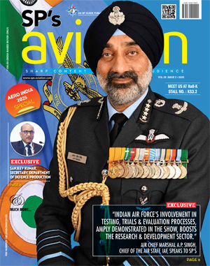
- Indian Air Force Aims for Full Indigenous Inventory by 2047 — Air Chief Marshal A.P. Singh
- Rajnath Singh assumes charge as Defence Minister for the second consecutive term
- Interim Defence Budget 2024-25 — An Analysis
- Union Defence budget 2024
- Prime Minister Modi Flies in the LCA Tejas
- New Chapter in India-Italy Defence Ties
- Airpower beyond Boundaries
Northrop Grumman Demonstrates the Future for Deep-Sensing for the US Army

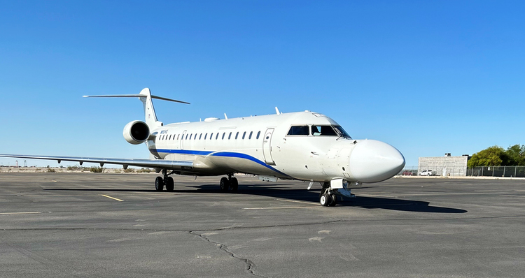
Northrop Grumman Corporation successfully demonstrated its Deep-Sensing and Targeting (DSaT) platform at the Experimental Demonstration Gateway Event (EDGE) ’23, hosted by the US Army.
During a simulated, real-world tactical scenario, the company successfully:
- Gathered and fused multi-domain data for rapid dissemination to the Tactical Operations Center;
- Collected and analyzed data from commercial satellites onboard the aircraft;
- Met 100-percent of the criteria for the experimentation
Expert:
Pablo Pezzimenti, vice president, integrated national systems, Northrop Grumman: “Northrop Grumman’s groundbreaking technology can help the Army realize its vision of deep-sensing with the ability to identify, monitor, target and strike threats from farther distances and with greater precision. We are supporting the warfighter’s targeting needs with intelligence collection beyond line of site and leveraging aerial assets in providing multi-domain fused data directly to the front lines.”
Details on DSaT:
DSaT is a multi-domain deep-sensing architecture integrated into a civilian aircraft, providing intelligence collection that reaches beyond the visual line of sight of local sensors. While leveraging elements of the TITAN pre-prototype system, its capability fills a gap in data collection by combining space-based geospatial intelligence (GEOINT) imagery with aerial and terrestrial intelligence from commercial and military space systems.
Phase 1 successfully demonstrated the GEOINT capabilities with future phases planned incorporating multiple intelligence platforms.


