

INDIAN ARMED FORCES CHIEFS ON
OUR RELENTLESS AND FOCUSED PUBLISHING EFFORTS

SP Guide Publications puts forth a well compiled articulation of issues, pursuits and accomplishments of the Indian Army, over the years

I am confident that SP Guide Publications would continue to inform, inspire and influence.

My compliments to SP Guide Publications for informative and credible reportage on contemporary aerospace issues over the past six decades.
Space - Expanding Roles
With space having emerged as the fourth medium for military operations, the IAF had brought out its blueprint titled ‘Defence Space Vision 2020' in 2007. The IAF had also laid claim to the Aerospace Command as a natural progression for them.
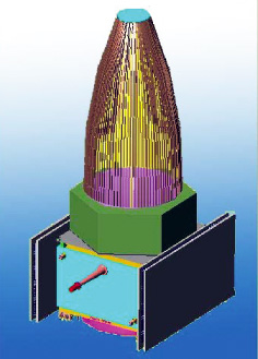
In the past five decades since the United States and Russia competed to launch satellites into outer space, the scientific, commercial, and military development of space has advanced at a rapid pace. Though space has not been transformed into a new field for armed conflict, its potential for militarisation makes it essential for nations like India to be prepared for such an eventuality. The advanced nations use space-based systems for intelligence, surveillance and reconnaissance (ISR), and navigation/communications. Space was utilised initially for peaceful purposes such as telecommunications, remote sensing, disaster warning and relief, etc. Gradually, the military has found satellites to be one more system that gives them round-theclock surveillance of areas of interest; they have found satellitebased navigation to be very precise and enable communication to reach remote areas.
At the same time, space is a place without frontiers! Who controls the skies beyond earth’s limits? Can disagreements be resolved peacefully? The potential risks increase as nations with growing political, military, and economic ambitions—notably China, Iran, Pakistan and others—quickly develop expertise. The use of space information systems to oversee adjoining borders, monitor military forces and movements, etc could make nations opt for ways and means to protect their assets by military means.
What has been India’s approach in preparing for such a scenario?
Despite being a developing economy with its attendant problems, India has effectively developed space technology and has applied it successfully for its rapid development. During the formative decade of 1960s, space research was conducted by India mainly with the help of sounding rockets. The Indian Space Research Organisation (ISRO) was formed in 1969. Space research activities were provided additional fillip with the formation of the Space Commission and the Department of Space by the Government of India in 1972. Later, ISRO was brought under the Department of Space that same year.
In the history of the Indian space programme, the 1970s were the era of experimentation during which experimental satellites like Aryabhatta, Bhaskara, Rohini and Apple were launched. The success of these programmes, led to an era of operationalisation in 1980s during which, operational satellite programmes like INSAT and IRS came into being. Fruitful cooperation with other space faring nations, international bodies and the developing world is one of the main characteristics of India’s space programme.
The Indian military had been taking tentative steps towards using the space arena for reconnaissance and communication purposes but had not put in place a dedicated military satellite in space. India decided to develop an independent indigenous reconnaissance satellite capability after the 1999 incursion of Pakistani troops into Kashmir caught it by surprise. Several of India’s current civilian satellites have resolutions that would make them acceptable spy satellites. The Technology Experiment Satellite (TES), launched by ISRO in 2001, can distinguish objects and details on earth as small as one square metre. The satellite is capable, for instance, of identifying troop movements along the Pakistani border. ISRO says its programmes are civilian-related, but the organisation has demonstrated its willingness to undertake military enterprises in the past. TES is reported to have transmitted high-quality images of the war in Afghanistan and of Pakistani troop movements along the border.
Though the Cartosat satellites have been developed for cartographic purposes, their potential dual-use (civilian and military) functions and reconnaissance capabilities could certainly enhance military interests and operations as well.
Indian satellite capabilities have considerable implications for current nuclear deterrence stability with Pakistan. The planned military surveillance and reconnaissance system could provide India with coverage of Pakistan’s military installations, enhancing its ability to counter Pakistani forces and military operations. For instance, India would have the option of reliably launching a conventional strike against Pakistan’s F-16s and other nuclear weapon delivery systems at their bases. Pakistan’s missile forces could also be detected and monitored by Indian satellites, and therefore, might not be able to escape an Indian pre-emptive strike, a factor which weakens Pakistan’s deterrence.
China’s growing space capabilities needs to be considered by India. While trade has increased substantially between the two nations in the last decade, the relationship continues to have a competitive slant, particularly in the area of military and strategic interests. China’s shooting down of a defence communication satellite and recent cyber attacks on India originating from China, need to be viewed with concern and countermeasures need to be developed.
India’s satellite intelligence capabilities could also provide its military planners tactical and strategic information on Chinese military forces in Tibet. Satellite reconnaissance would give Indian armed forces sufficient early warning about the movement of Chinese military forces from central China towards Tibet and India, thereby aiding the deployment of Indian forces in time to counter any movement of Chinese troops.
The implementation of the military surveillance and reconnaissance system would provide India with dedicated military satellite intelligence that would enhance the increasing role satellites play in India’s security concerns.
SP's Aviation - Current Issue